Latest Information
October 2025: Draft Study Report
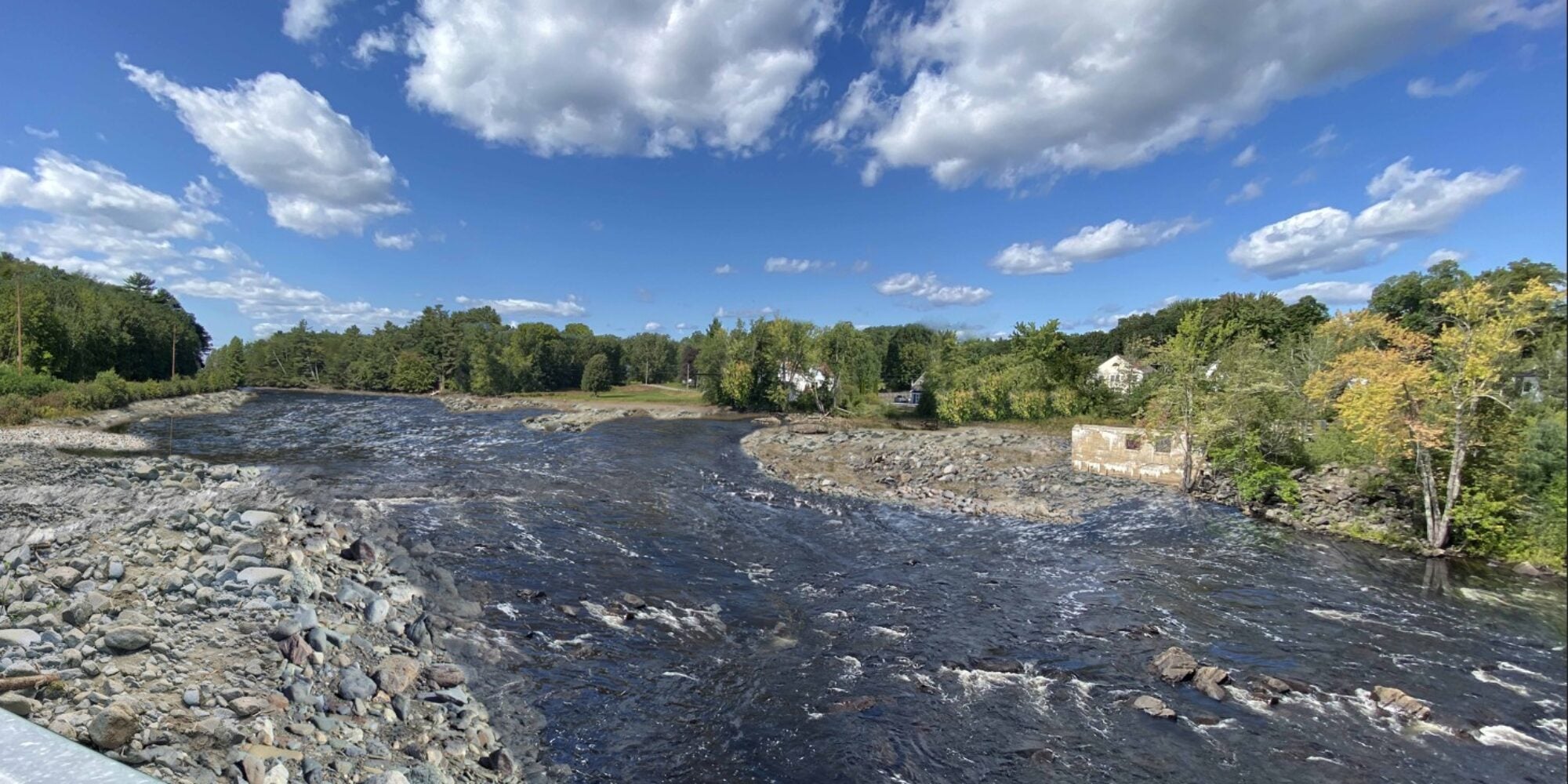
BWPH is issuing a draft study report (DSR) to summarize baseline data at the Project related to geology and soils, water quality and quantity, fish and aquatics, wildlife and botanical resources, recreation, land use, aesthetics, and historical structures. The DSR is not intended to contain specific details on BWPH’s proposal for decommissioning the Bar Mills Project, and its contents will not change regardless of the proposed methodology. Rather, the DSR serves as a foundation for identifying protection, mitigation, and enhancement measures that will be addressed in a Draft Decommissioning Plan and License Surrender Application, which BWPH will issue for public review and comment in early 2026. The following documents are available for review:
- – Cover Letter
- – Executive Summary
- – Draft Study Report
- – Appendix A (Committee Summary):
- – Appendices (A-H) Combined
August 2023: Final Study Plan – Bar Mills Hydroelectric Project
Background Information
Brookfield White Pine Hydro (BWPH) issued a Draft Study Plan on May 31, 2023 to provide the federal and state agencies, stakeholders and the general public with a description of studies and methodologies that BWPH intends to conduct in support of the Application for License Surrender and Decommissioning Plan for BWPH’s proposed partial breach of the Bar Mills Dam that will be filed with FERC. Studies will inform analysis of potential project effects and mitigation measures and provide information necessary for state and federal permit applications [e.g., Maine Department of Environmental Projection’s (MDEP) Maine Waterway Development and Conservation Act (MWDCA) and US Army Corps of Engineers (USACE) Section 401 permit applications].
Following consultation with the resource agencies on dam breach and removal options, BWPH issued a Preliminary Scoping Document (PSD) on August 1, 2022, describing the Project, and the proposed action for decommissioning of the project structures and surrender of the project license, including partial dam removal. Comments were requested to be submitted by September 1, 2022.
BWPH held a public informational meeting for the license surrender and decommissioning process, including presentation of plans for partial dam removal, for the Project at the Town of Buxton municipal office on August 2, 2022.
BWPH compiled a list of resource issues and studies to be conducted in 2022 and 2023, partially informed through public outreach, which was posted to the project website and distributed to stakeholders on December 5, 2023. BWPH requested that comments and additional study requests be submitted by January 6, 2023. See Section 5.0 for discussion of study requests received, which informed development of the Proposed Study Plan.
BWPH issued the Draft Study plan for 30-day agency and public comment and requested any comments be submitted in writing by June 30, 2023.
BWPH had intended to conduct all studies described herein during the summer and fall of 2023, however, due to the abnormally high level of precipitation in Maine and New England during the summer, most of the studies were delayed to 2024. A Draft Study Report focusing on the findings of these studies was published in October 2025.
BWPH will file a Surrender Application and Decommissioning Plan with the FERC, likely in early 2026. This schedule may be subject to change as ongoing agency and public consultation continues and BWPH will keep FERC and the public apprised of any changes to the schedule. The current target schedule is provided on the Bar Mills Decommissioning website at: https://barmills.brookfieldusprojects.com/process-schedules/.
Additional opportunity for agency and public comment will occur as part of the development of the Final Study Report and, upon issuance of the Draft Surrender Application and Decommissioning Plan, as part of the scoping process following the submittal of the Surrender Application and Decommissioning Plan to the FERC, as well as pursuant to the local, state and federal permitting processes. Additional information regarding the surrender process is available at https://barmills.brookfieldusprojects.com/.
Revision Date: 08/31/2025
